









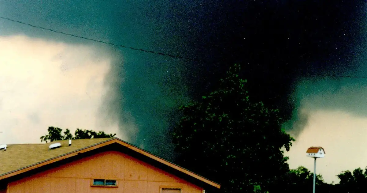

The Northeast isn’t just staring down a storm; it’s on the verge of a full-blown meteorological assault. An urgent tornado warning has been issued, threatening millions across several states in mere hours. This isn’t a practice run, folks. This is game day, and the stakes couldn’t be higher.
Forecasters aren’t just predicting a severe storm outbreak; they’re sounding the alarm with the urgency of a fourth-quarter, two-minute drill. The National Weather Service (NWS) has elevated its warnings, expecting not just isolated incidents, but multiple tornadoes, large hail, and damaging winds that could rip through communities like an unblocked blitz.

Northeast Faces Enhanced Risk: The Tactical Breakdown
The clock is ticking. As of late Tuesday morning, July 21, 2026, the NWS Storm Prediction Center (SPC) has placed parts of the Mid-Atlantic and Southern New England at an “Enhanced” risk. This isn’t just a moderate threat; it’s Level 3 out of 5 for severe thunderstorms – a significant threat that demands immediate attention. A wider “Slight” risk covers Pennsylvania, New York, New Jersey, Connecticut, Massachusetts, and Rhode Island. Even those on the fringes aren’t out of bounds.
Tornado watches commenced early today, covering central Pennsylvania and western Maryland. By midday, these watches pushed east, extending into New Jersey and New York’s Hudson Valley. The main threat window runs from 3 PM EDT through midnight. Isolated tornadoes aren’t just a concern; they’re a primary threat, with the potential for devastating, strong systems to form. Damaging winds over 60 mph and hail up to two inches wide are also expected to hammer the region. Heavy rain rates aren’t just a nuisance; they’re the direct culprit for flash flood watches. Streets could turn into rivers in an instant.
Schools and community centers aren’t just reacting; they’re executing rapid-response protocols. Areas like suburban Philadelphia and central New Jersey have dismissed students early. Evening activities are canceled across the board. Emergency agencies aren’t just ‘telling’ residents; they’re issuing a direct command: get ready. Secure multiple warning channels. Reviewing severe weather safety plans isn’t critical; it’s non-negotiable. This is your playbook for survival. Power outages have already hit western Pennsylvania as initial storms rolled through, a grim preview of what’s to come.
“The atmospheric ingredients are all coming together for a significant event. We have strong wind shear, ample moisture, and instability. This isn’t a typical summer pop-up storm scenario; this is a well-forecasted, potentially dangerous outbreak.” — Dr. Sarah Chen, NWS SPC lead forecaster
Preparedness Under Fire: Is the Northeast Ready for the Blitz?
The real question now: How prepared is the Northeast for a major tornado outbreak? What specific steps are authorities taking? It’s a high-stakes game. Millions live in the path of this storm. Every play counts, and a misstep could prove fatal.
Advanced Warning Systems in Action
The NWS isn’t playing catch-up; they’re executing a proactive game plan. Utilizing advanced radar and predictive modeling, tornado watches were deployed hours ago – a critical early warning. When confirmed rotation is spotted, specific tornado warnings are delivered within minutes, providing invaluable lead time. This isn’t just good strategy; it’s the difference between life and death on the field.
“We are witnessing a rapidly escalating situation, and the potential for significant tornadoes is real. We cannot stress enough the importance of having a plan and acting on warnings immediately.” — Dr. Sarah Chen, NWS Storm Prediction Center
State-Level Emergency Declarations: Deploying the Assets
Governors aren’t just ‘activating their teams’; they’re deploying their top-tier emergency assets. New York, New Jersey, and Pennsylvania have pre-positioned emergency responders, a tactical move to ensure rapid deployment. State-level emergency operations centers are active, coordinating resources and aid. This is about strategic asset deployment, ensuring resources are precisely where they’re needed, before the first whistle blows.
“Our priority is public safety. We are asking all residents in the watch and warning areas to take these threats seriously, stay informed, and have a safe place to go if a tornado warning is issued for their specific location.” — Governor Phil Murphy of New Jersey
Public Education Campaigns: Will the Message Land?
Local emergency management has been pushing public awareness relentlessly. For the last 24-48 hours, they’ve urged residents to identify safe spots at home and sign up for local alert systems. But will people listen? Will the message cut through the noise? That’s the million-dollar question, and the answer will be measured in lives and property saved.
“We get thunderstorms, but tornado warnings are rare here. It’s unsettling, especially with kids at home.” — Maria Rodriguez, Trenton, New Jersey resident
“My biggest fear is the kids being at school when something hits. It’s why I picked them up early. You just can’t be too careful.” — Lisa Chang, parent from Westchester County, NY
Shelter Availability and Infrastructure: A Prepared Defense
Community centers and schools stand ready, designated as emergency shelters in high-risk zones. The primary directive remains clear: shelter in place. Utility companies, anticipating inevitable power outages, have mobilized their crews. Equipment and personnel are pre-staged. This tactical move is designed to speed up power restoration and minimize downtime. This isn’t hope; it’s a prepared response.
The SPC’s “Enhanced” risk zone covers about 5 million people. The “Slight” risk area includes over 30 million people. These aren’t just numbers; they’re indicators of a volatile atmospheric cocktail, primed for destruction. Forecast models show high Helicity, meaning a strong potential for rotating updrafts. Wind shear values are projected at a staggering 40-50 knots – conditions highly favorable for tornado genesis. The NWS has already issued over 20 severe thunderstorm warnings and put out 5 tornado warnings across the Mid-Atlantic and lower Northeast. This signals the early stages of this unfolding crisis.
The Northeast might not be “Tornado Alley,” but to dismiss its vulnerability would be a catastrophic miscalculation. History provides stark evidence: the brutal 1989 Connecticut tornadoes and the devastating 2011 Springfield, Massachusetts EF-3 tornado ripped through dense urban areas. These events caused widespread damage and claimed lives. These weren’t anomalies; they were grim warnings. The current forecast isn’t just hinting; it’s screaming that a similar, potentially deadlier, scenario is on the table. This demands an emergency response unlike any seen in years.
The Red Marker Verdict: A Call to Action
Here’s the cold, hard truth, stripped bare of any sugarcoating. All the meticulously crafted warnings, all the strategic pre-positioning of assets, all the emergency declarations – they’re formidable on paper. But when that first gust howls, when the sirens scream their urgent warning, the true measure of readiness isn’t found in a government playbook. It’s in the immediate, decisive response of the people. The cynical reality, as I see it, is that despite every official urging, a significant chunk of the population will still be caught off guard. They will ignore the warnings, convinced it can’t happen to them. That’s precisely where the financial and human cost truly hits. That’s where the game is lost.
The damage will pile up like yards after contact. Recovery will demand billions, a gut punch to local economies that will take years to heal. The long-term cleanup and rebuilding efforts will expose the fragile reality beneath the surface. We can plan all we want, but human nature remains the ultimate wild card. The Northeast is about to find out just how ready it truly is, not just in theory, but in the brutal, unforgiving trenches of a real-time disaster.
This isn’t just a forecast; it’s a direct threat to lives and property. Millions in this densely populated region face immediate danger. Power outages will cripple daily life. Commerce will grind to a halt, and property damage will demand costly repairs. The ripple effect on travel, businesses, and supply chains will be immense. Forget the waiting game. This is a game-time decision, right now, for every single person in the storm’s path. Protect your families. Secure everything outside. Prepare for extended power loss, or even evacuation. Your immediate action isn’t just advised; it’s your only defense against this incoming blitz.
Source: Google News